Call or text when ready to purchase
TwoOneZero-300-1759
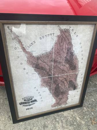
Large Official map of the County of Napa, California 1867 Framed
Measures
36”x30”
$50
Local Pick up or Shipping Available
($80 shipped)
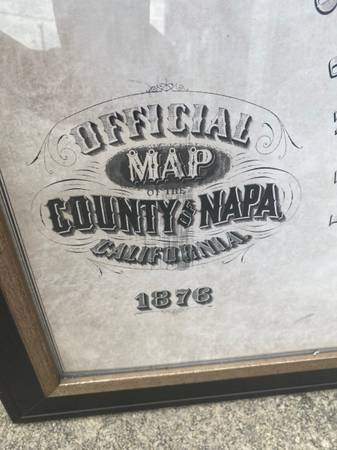
The image is of an official map of Napa County, California, dating back to 1876. Key details include:
• It was compiled from official surveys and records of the U.S. Surveyor General’s Office.
• The map was created by Lyman and Throckmorton, who were civil engineers.
• It shows the geographical boundaries and divisions of Napa County as they were in 1876.
• Napa County is located north of San Pablo Bay.
• As of 2020, the population of Napa County was 138,019.
• The county seat is the city of Napa, which was founded in 1847.
• Napa is a Native American word that has been translated as “house”.
Call or text when ready to purchase
TwoOneZero-300-1759
Please text or call only when on the way to purchase.